File:Map of Tael.png
Size of this preview: 800 × 533 pixels. Other resolution: 1,920 × 1,280 pixels.
Original file (1,920 × 1,280 pixels, file size: 3.91 MB, MIME type: image/png)
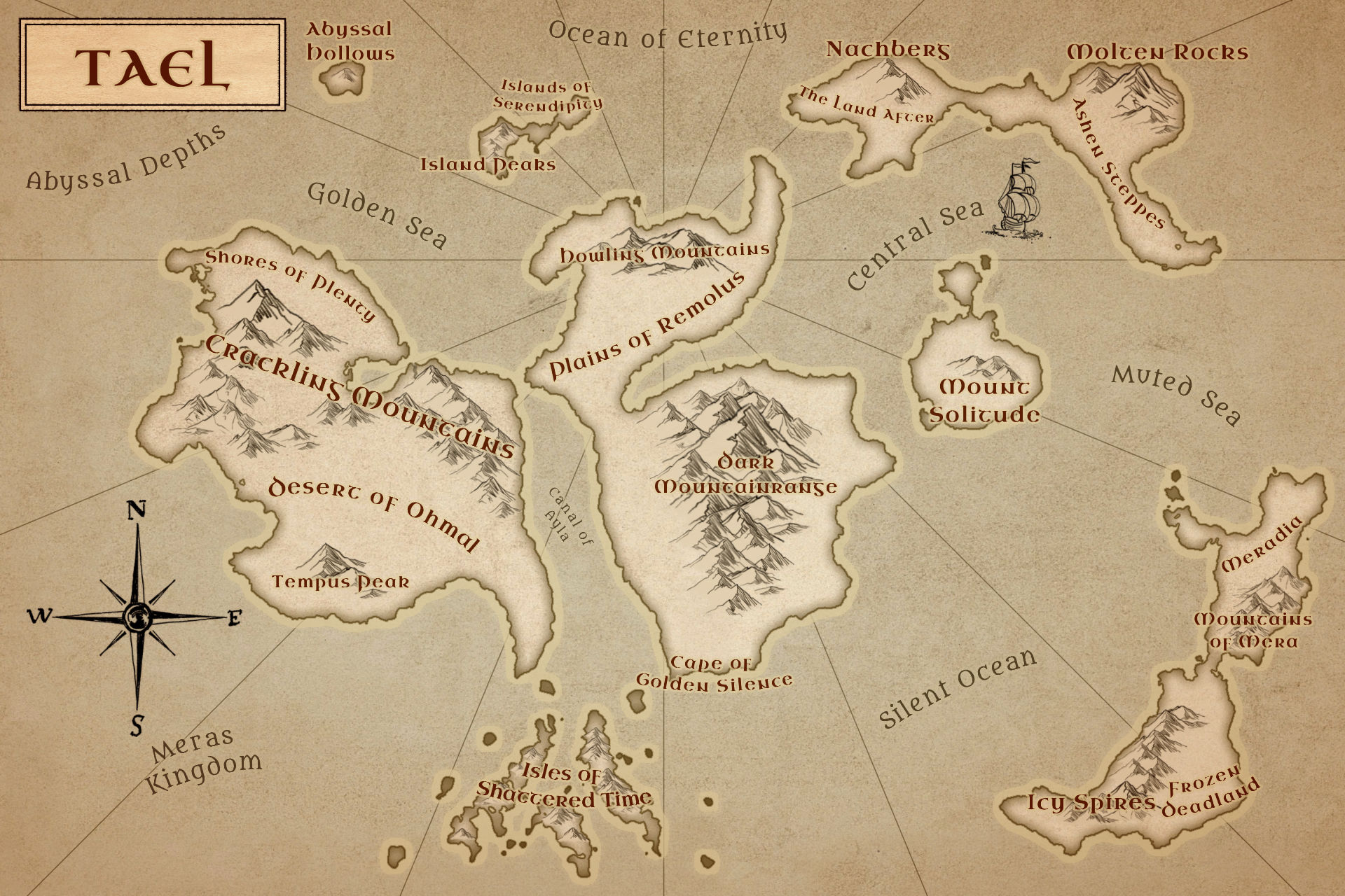
a Map of current Landformations of Tael
File history
Click on a date/time to view the file as it appeared at that time.
| Date/Time | Thumbnail | Dimensions | User | Comment | |
|---|---|---|---|---|---|
| current | 04:21, 10 December 2024 | | 1,920 × 1,280 (3.91 MB) | Larame (talk | contribs) | |
| 14:51, 6 May 2024 | 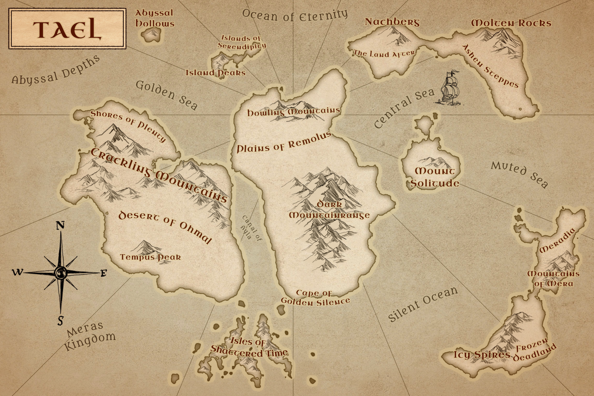 | 1,920 × 1,280 (3.89 MB) | Larame (talk | contribs) | Added some shattering to the tip of the canal, moved Silent Ocean "a bit" | |
| 17:52, 7 April 2024 | 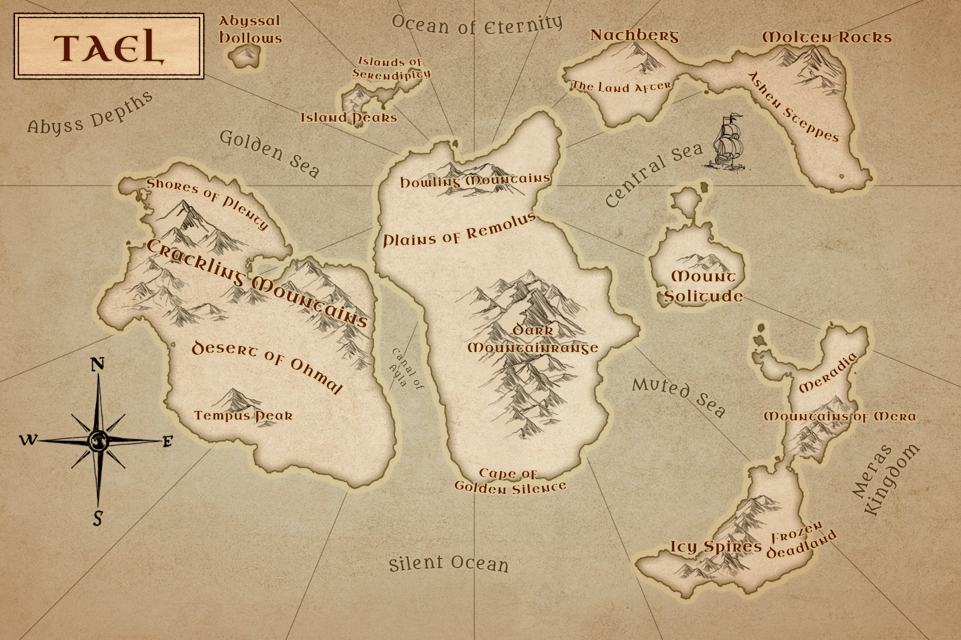 | 1,920 × 1,280 (3.85 MB) | Larame (talk | contribs) | Moved the Frozen Deadlands further south, because a geographer died when he saw the map | |
| 00:03, 27 December 2023 | 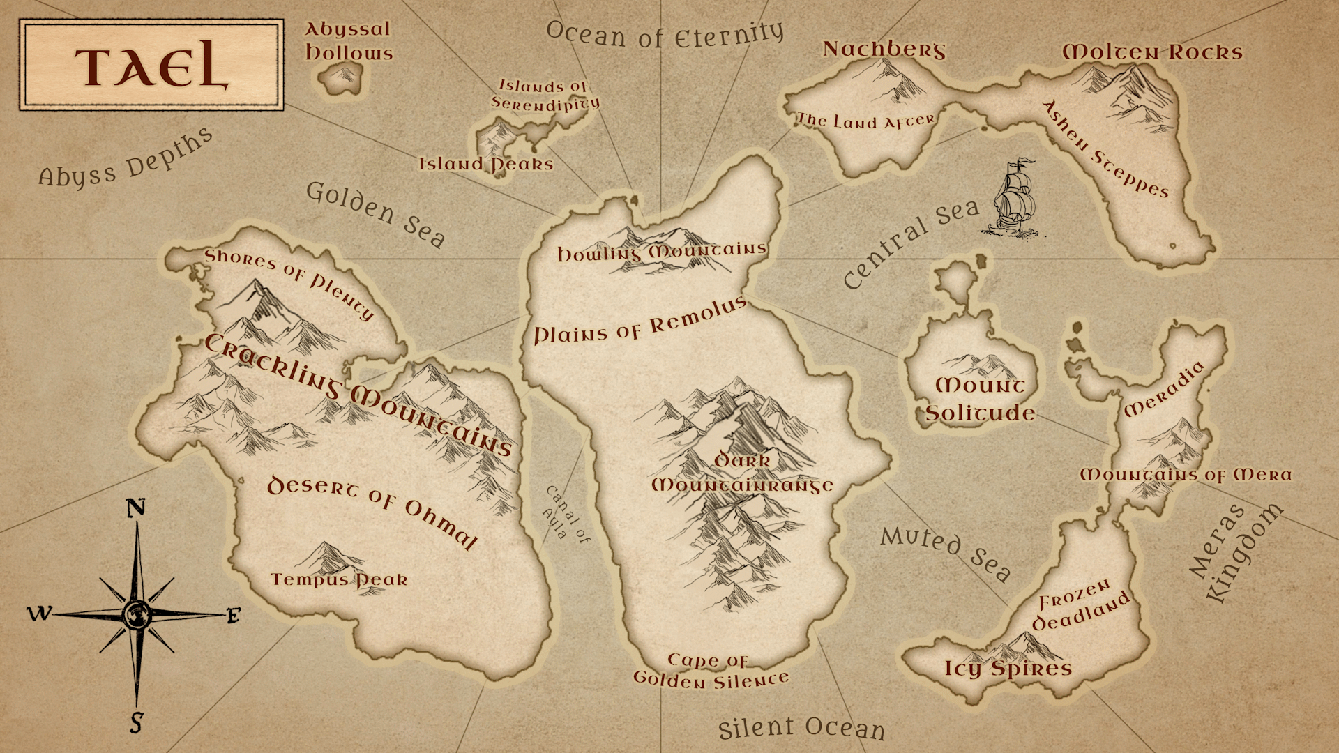 | 1,920 × 1,080 (1.26 MB) | Larame (talk | contribs) |
You cannot overwrite this file.
File usage
The following page uses this file: